At 8:15, there were already cars on the track. I climbed up the stairs to the second floor of the tower. Every track has a tower, a high vantage point for officials and media to keep eyes on the race taking place below.

Today was the first day of a regional SCCA championship race. Eight groups of cars would qualify and compete before the day was up. SCCA rents the track at a daily rate and they were going to squeeze every last minute of racing out.
My job for the day was to keep track of timing. I wasn't alone though. In the two pilot's chairs were Steve and his wife. Their laptops blinked and buzzed as cars passed the start/finish line, a sign that their transponders were working. Throughout the day our couple would shout out ticker tape headlines. "Car 60, transponder out." "New leader, 29."
I didn't get a laptop. Instead, there was a seat at the end of our five-person row. Bearing down on a green laminate table, my job was to tape each car as it came by. This was the old school way. I was instructed to write down the number of each car each time it crossed the line, flipping to a new piece of paper with each new lap.

Next to me sat Tom, a quiet man in his 60s. He knew everything that went on on track, from the race classes, to the estimated number of laps in a 20-minute race, to the speeds certain cars would reach on the back straight. While the other tapers used pens, he sharpened his number two pencil after each heat.
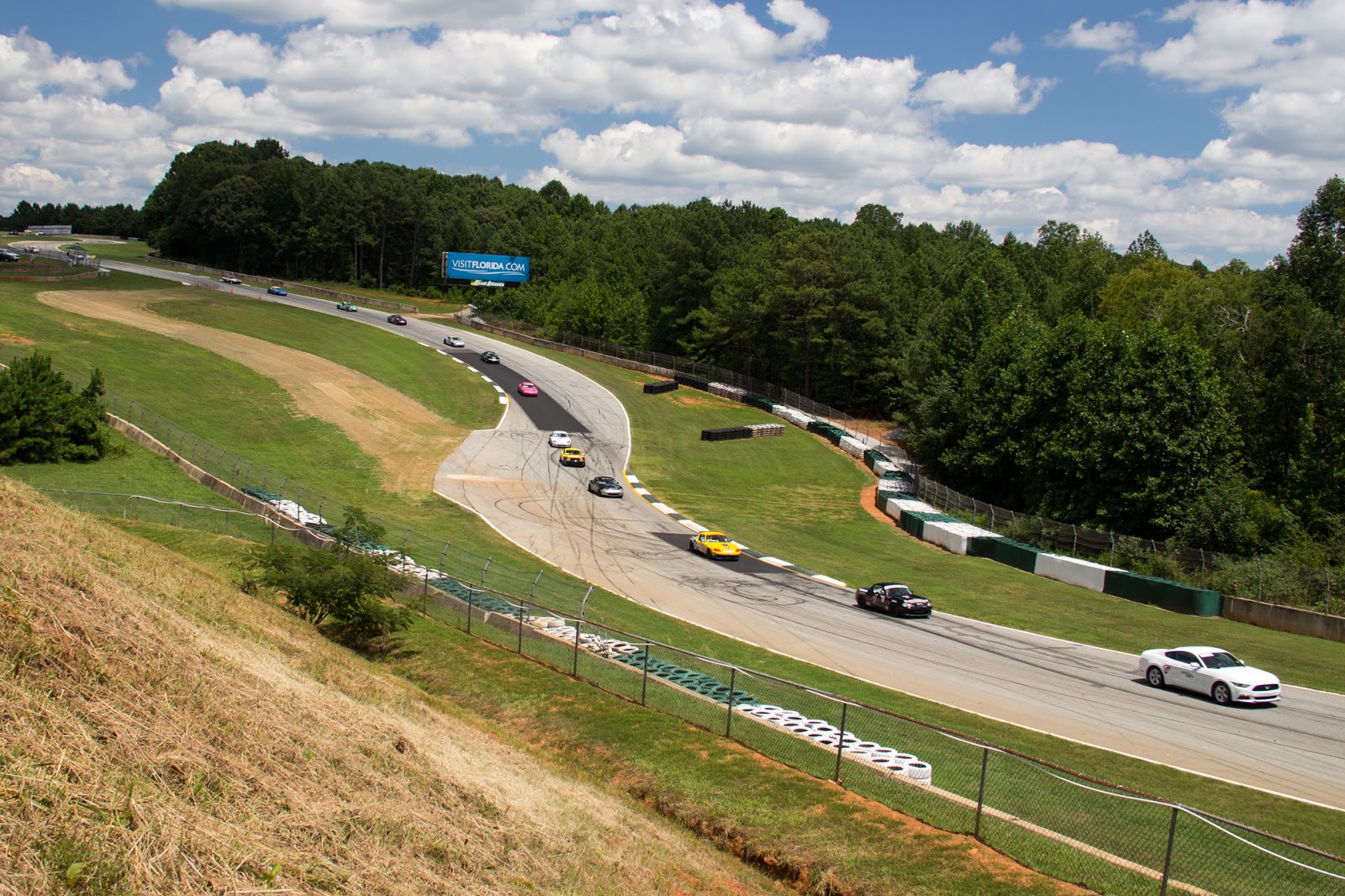
The first few qualifying rounds were easy to keep up with. Here, the fields were small, six to 15 cars. The challenge came when the Spec Miatas got on track. There were 32 cars registered in the Spec Miata class, and groups of four to ten cars would bunch together as they came down the hill. Tapers were expected to make errors. The point in having several were the hopes that if one taper missed a group of cars crossing the line, the other will have gotten those, but probably missed some others.
Our team stayed pretty quiet most of the day. Tom opened up individually wrapped yellow Lifesavers and Caffeine free Diet Pepsi. I drank my medium roast coffee from the Pilot station wishing I'd added more than one creamer. After each session, the chief timer would call "Five minutes," signaling that we could take a bathroom break or run back to the kitchen for snacks.


The biggest challenge of the day was the final race, which was a 90-minute endurance race. There were 28 cars competing, but by the end only half of them would still be running. Our directives this time came with a manila envelope full of numbered pieces of paper. There were 50 sheets total, and we'd end up filling each one.
Each car was allowed two trips to pit lane, but quite a few didn't even get the opportunity. A Formula Ford led most of the race until it pitted, ceding the lead to a black Porsche 944. As the race went on, the higher pitched note of cracked headers became more familiar. A Nissan Pickup, one of my favorite underdogs, and a late model Honda Civic sputtered out, while a couple of the British roadsters smoked across the line before being towed in ahead of the finish.
That marathon taping run wiped me out. The next day, I arrived for an afternoon photo session, where I caught a couple of the groups in championship races.
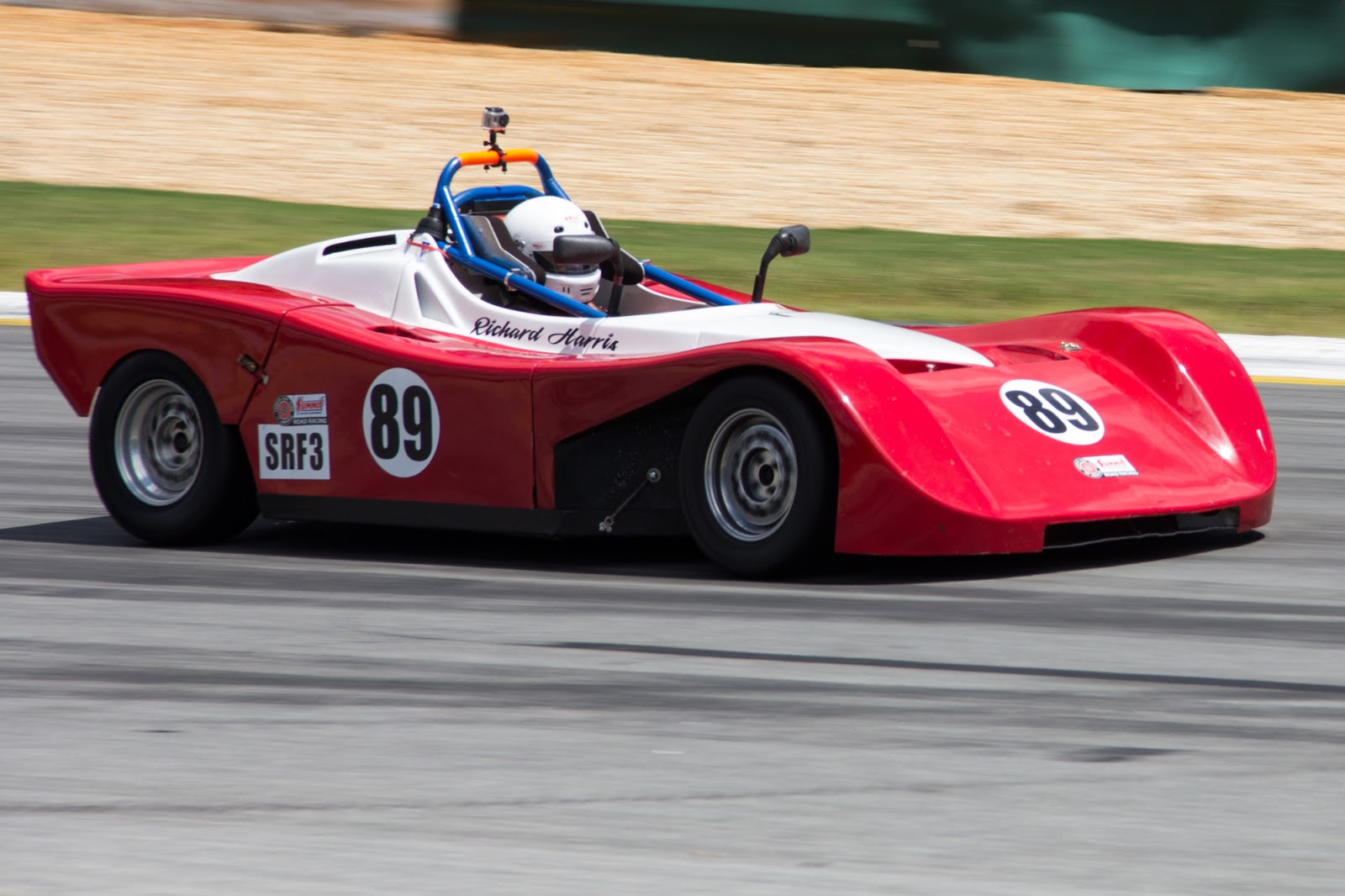
The first to run were IT class cars. IT stands for Improved Touring, so these were essentially street cars with roll cages and different wheel and tire combinations.


After that, a small group of Formula Fords ran.


And after the Fords were the Spec Miatas. Because of their handling prowess and a supportive aftermarket for parts, Miatas have become a go-to car in sports car racing. The field today numbered 28, and several small battles raged during the afternoon's race.


Today was the first day of a regional SCCA championship race. Eight groups of cars would qualify and compete before the day was up. SCCA rents the track at a daily rate and they were going to squeeze every last minute of racing out.
My job for the day was to keep track of timing. I wasn't alone though. In the two pilot's chairs were Steve and his wife. Their laptops blinked and buzzed as cars passed the start/finish line, a sign that their transponders were working. Throughout the day our couple would shout out ticker tape headlines. "Car 60, transponder out." "New leader, 29."
I didn't get a laptop. Instead, there was a seat at the end of our five-person row. Bearing down on a green laminate table, my job was to tape each car as it came by. This was the old school way. I was instructed to write down the number of each car each time it crossed the line, flipping to a new piece of paper with each new lap.
Next to me sat Tom, a quiet man in his 60s. He knew everything that went on on track, from the race classes, to the estimated number of laps in a 20-minute race, to the speeds certain cars would reach on the back straight. While the other tapers used pens, he sharpened his number two pencil after each heat.
The first few qualifying rounds were easy to keep up with. Here, the fields were small, six to 15 cars. The challenge came when the Spec Miatas got on track. There were 32 cars registered in the Spec Miata class, and groups of four to ten cars would bunch together as they came down the hill. Tapers were expected to make errors. The point in having several were the hopes that if one taper missed a group of cars crossing the line, the other will have gotten those, but probably missed some others.
Our team stayed pretty quiet most of the day. Tom opened up individually wrapped yellow Lifesavers and Caffeine free Diet Pepsi. I drank my medium roast coffee from the Pilot station wishing I'd added more than one creamer. After each session, the chief timer would call "Five minutes," signaling that we could take a bathroom break or run back to the kitchen for snacks.
The biggest challenge of the day was the final race, which was a 90-minute endurance race. There were 28 cars competing, but by the end only half of them would still be running. Our directives this time came with a manila envelope full of numbered pieces of paper. There were 50 sheets total, and we'd end up filling each one.
Each car was allowed two trips to pit lane, but quite a few didn't even get the opportunity. A Formula Ford led most of the race until it pitted, ceding the lead to a black Porsche 944. As the race went on, the higher pitched note of cracked headers became more familiar. A Nissan Pickup, one of my favorite underdogs, and a late model Honda Civic sputtered out, while a couple of the British roadsters smoked across the line before being towed in ahead of the finish.
That marathon taping run wiped me out. The next day, I arrived for an afternoon photo session, where I caught a couple of the groups in championship races.
The first to run were IT class cars. IT stands for Improved Touring, so these were essentially street cars with roll cages and different wheel and tire combinations.
After that, a small group of Formula Fords ran.
And after the Fords were the Spec Miatas. Because of their handling prowess and a supportive aftermarket for parts, Miatas have become a go-to car in sports car racing. The field today numbered 28, and several small battles raged during the afternoon's race.


